Tips about the road, sights and other good stuff from Reykjavík to Höfn on the South coast of Iceland
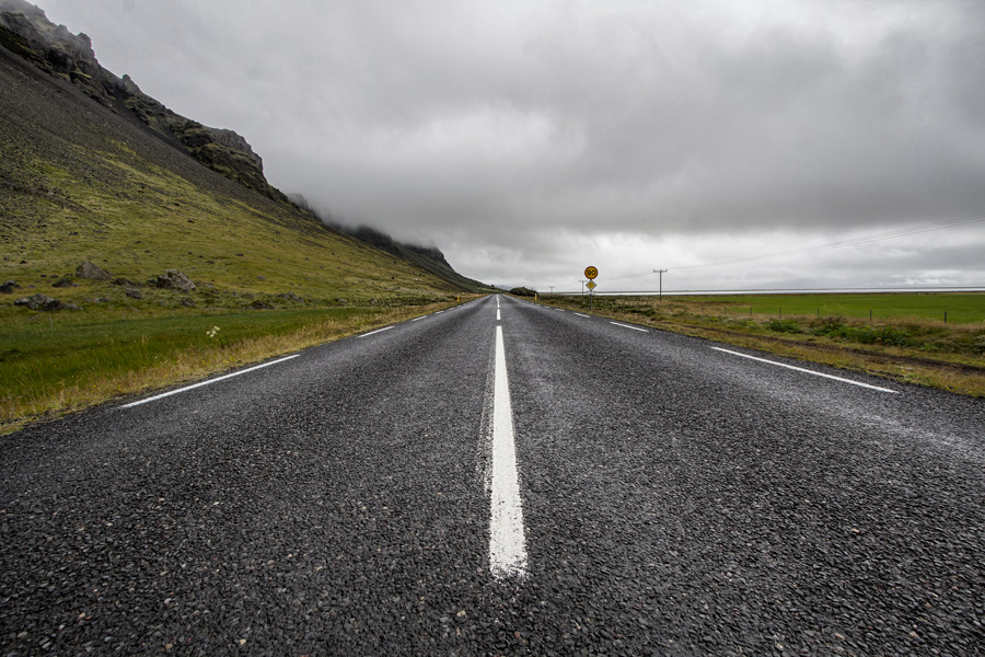
Photo by HeckticTravels.com.
About the Driving the ring road in Iceland blog series
Driving the road nr.1 or the ring road in Iceland is great fun and the beautiful sights on the way are sure to take your breath away. We have decided to blog about driving on the ring road in an attempt to clarify for travelers what they might expect (with emphasis on the driving part). These blogs are not a list of all the sights you can see in the area but rather an idea of how you might expect the roads to be, road sections to watch out for and how the weather can affect your trip. So put on your virtual seat belt and let’s start our journey on road 1 on the South coast of Iceland.
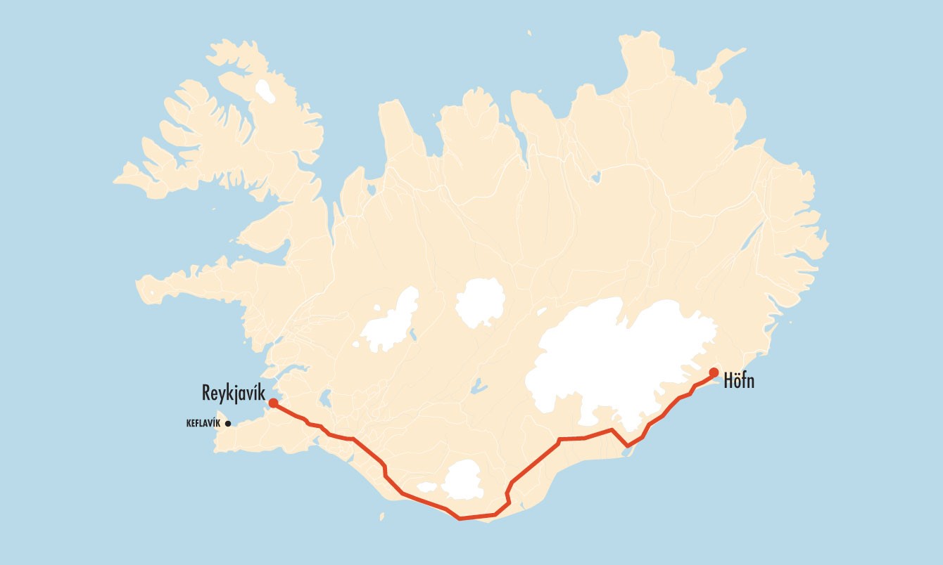
The South coast, from Reykjavik to Höfn
Driving time without stops about 6 hours.
Driving time without stops about 6 hours.
Asphalt road (only road 1).
Safe for all cars to drive (2wd and 4wd).
For the purpose of this blog, we have decided that the South coast is from Reykjavík city to the town of Höfn in Southeast Iceland. The south coast is a very popular driving area so you might expect heavier traffic on this part of the ring road as compared to other parts! Popular tourist sites such as the Golden circle are in the area. We will pass Eyjafjallajökull glacier and Mýrdalsjökull glacier, Skógafoss waterfall, the picturesque town of Vík, Skaftafell national park and Jökulsárlón glacier on the way, just to name a few. For a list of sights on the south coast, check out this Lonely Planet list or this Wikipedia article. If you want to know how some of these names are pronounced check out this fun Learn Icelandic podcast from I heart Reykjavik.
Driving from Reykjavik to the South Coast
This South coast part of the ring road #1 is all asphalt, there are no gravel parts on it. Most secondary roads in the south are also asphalt such as the Golden circle. The flatness of the South makes your ride a smooth and easy one all the way to Höfn. The roads are mostly one lane each side. Beware of the gravel on each side, it can cause gravel damage if you go out on it at full speed or when other cars are passing you.
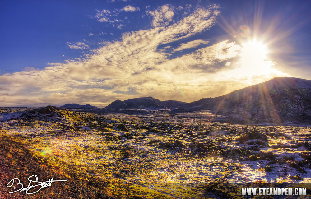
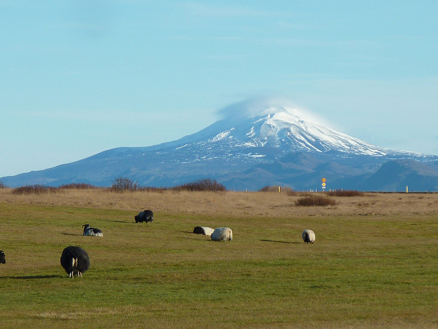
Photo of Hellisheiði mountain passage by Eyeandpen.com and Mt. Hella volcano by Julien Sebire, respectively.
Your journey from Reykjavik starts on Hellisheiði heath/mountain passage. As is with all mountain passages, the weather can be drastically different up there than in Reykjavík so check it before you leave, especially in the winter time. You can visit the Icelandic Road Administration for a map of road conditions which is updated every hour.
There are a lot of hot springs and even a geothermal plant on the way so don´t start blaming your travel mates if it smells like someone farted in the car, that is just the smell of sulphur. You go slowly up the heath but you feel how high up you are when you go down on the other side. If the weather and visibility is good we recommend you stop at the top and enjoy the view over the flat lowlands of the south. You might even see Eyjafjallajökull glacier and Eyjafjöll mountains at the horizon ahead.
The beautiful South coast to Eyjafjallajökull volcano
You will pass the "flower" town of Hveragerði with its greenhouses as well as the town of Selfoss which is the biggest town in the south. The speeding police is very active between the two towns and although we would like our customers to always drive within the speeding limit, this is a good part to be extra careful.
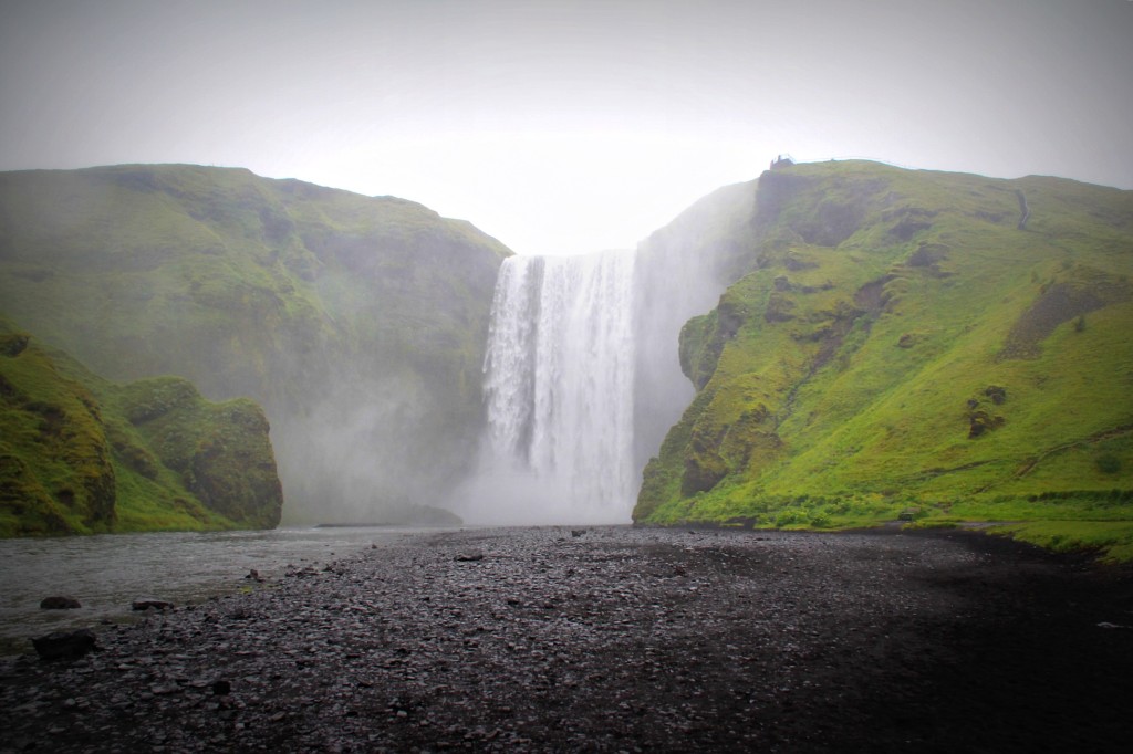
Photos, the view from the side of the road by Eyjafjöll mountains and Skogafoss waterfall, by The Lazy Travelers.com.
In clear weather you will have good view into the highlands (to your left) from the town of Selfoss and on. You might be able to spot the very long and flat Langjökull glacier as well as Mt. Hekla, one of the most active volcanoes in Iceland erupting every 10 years or so. To your right you might spot the Vestmannaeyjar islands, if you have a chance to spend a day there we highly recommend it as it is quite beautiful there.
You will reach Eyjafjöll mountains (quick language class, Eyjafjöll means Islandsmountains and Eyjafjallajökull means Islandsmountainsglacier, pretty straightforward naming there don´t you agree. The islands are of course the Vestmannaeyjar islands). Many people stop at Seljalandsfoss waterfall and Skogar waterfalls. The green Eyjafjöll mountains are spectacular as well so this part of the way is very beautiful. You will then drive on to the little town of Vík. Many visitors stop at the black beach of Reynisfjara or enjoy the view over to Reynisdrangar pillars that are out in the ocean.
Photo of Pétursey near the town of Vík by Michał Sacharewicz and Mýrdalsjökull glacier near Vík by Djof, respectively.
The landscape changes to black sands and lava fields
Once you pass Vík the landscape changes from green valleys and mountains to the black sands of Mýrdalssandur sands. This is basically a black sand desert with a lot of single-width bridges. The ring road after Vik is slightly narrower as well which makes the driving experience a little different then what we have experienced so far.
Once you leave the black sands behind you will cross into Eldhraun lava field (rough translation is Firelava) which was created in one of the biggest eruptions in recorded world history. The eruption had devastating impact in Iceland as well as in Europe where it might have contributed to reasons that brought on the French revolution in 1789. As you can imagine the lava fields are huge, about 565 km2. If you have a 4x4 car that is allowed to go into the highlands you can visit Lakagígar craters which were also formed in the same eruption, you will find the turn near the town of Kirkjubæjarklaustur. The roads are still similar, they are all narrow asphalt, single-lane roads and mostly through flat landscapes.
Once you leave the black sands behind you will cross into Eldhraun lava field (rough translation is Firelava) which was created in one of the biggest eruptions in recorded world history. The eruption had devastating impact in Iceland as well as in Europe where it might have contributed to reasons that brought on the French revolution in 1789. As you can imagine the lava fields are huge, about 565 km2. If you have a 4x4 car that is allowed to go into the highlands you can visit Lakagígar craters which were also formed in the same eruption, you will find the turn near the town of Kirkjubæjarklaustur. The roads are still similar, they are all narrow asphalt, single-lane roads and mostly through flat landscapes.
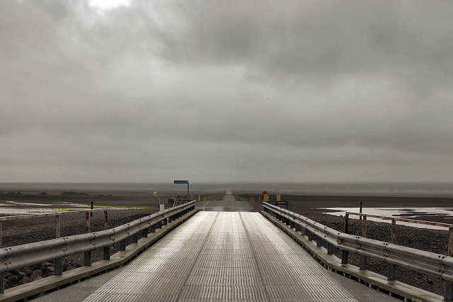
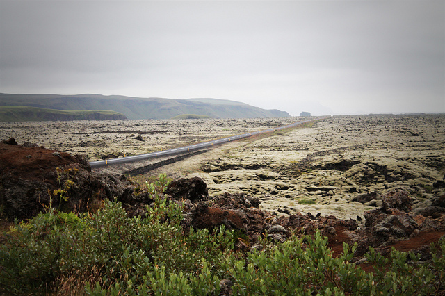
Photo of Mýrdalssandur desert by Malcolm Browne and of Eldhraun lava field by Rufus Gefangenen, respectively.
Leaving Eldhraun behind you will travel over Skeiðarársandur sands towards Skaftafell national park where the biggest glacier in Europe, Vatnajökull glacier, awaits you. The journey over Skeiðarársandur is ruggedly beautiful, black sands with the highest peak in Iceland, Hvannadalshnjúkur, straight ahead in the national park. Again you will cross glacier rivers on single-width bridges that only have double-width places to meet an oncoming car every once in a while. Please drive carefully on these bridges.
Sometimes the forces of nature are too strong for man-made things. Skeiðará river and other rivers in the area sometimes go on glacier runs destroying any bridge or road that stands between it and the ocean. This happens rarely but as recently as 2011 on Mýrdalssandur sands.
Jökulsár glacier lagoon to the village of Höfn
We do recommend you stop at Skaftafell national park and hike to the glacier (although please do not go on it as those things are dangerous without guided supervision).
Another tip; there are no stores or restaurants in the area from the town of Kirkjubæjarklaustur to Höfn except Freysnes near Skaftafell which has ludicrous prices. So we suggest you stock up on refreshments before you reach this part of the way or be prepared to pay an arm and a leg for your coffee and sandwich.
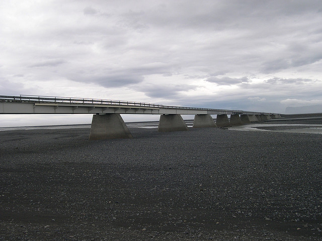
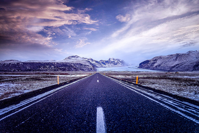
Photo of Skeiðarársandur bridge by mifl68 and of the road to Skaftafell national park by Andrés Nieto Porras, respectively.
Once you make it to Jökulsárlón glacier lagoon, you will have had Vatnajökull glacier on your left for a while enjoying the spectacular scenery. Well, the view does not get any worse at the glacier lagoon so make sure you stop there and don´t forget your camera folks. For an idea of what to expect at the glacier lagoon check out For91days.com blog about it.
The landscape is similar all the way to the charming lobster town of Höfn, beautiful glacier on the left and black sands and the ocean on your right.
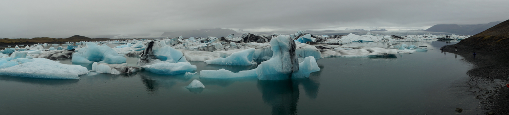
Photo by Sam Rye.
As you might have noticed, there is a lot of sand in the south with all these black sand deserts. This can cause sand or ash storms, mostly in fall, winter and spring. For more information please read our blog on how to avoid getting into sandstorms in Iceland. We suggest you check the conditions just before you visit Iceland and purchase Sand and ash protection (1895 ISK per day for smaller cars, 2595 ISK per day for larger cars, 150000 self-risk) if the chances of a storm are high.
Be safe and happy while driving in Iceland
We remind you that the speeding limit is 90 km/h on asphalt roads and 80 km/h on gravel roads. The speeding limit in towns is 50 km/h. The police frequently checks speeding in the area and there are a lot of speeding cameras so we advise you to respect the speed limit.
Also, please be aware that off-road driving is against the law in Iceland as it causes real and irreversible damage to the Icelandic nature that could take decades to heal. Please do not drive off roads even if you see tire tracks!
Well, that was the first part of the ring road. We hope you enjoyed the ride. We will continue our journey through the beautiful Eastern fjords soon, see all other blogs in this series below.
Until next time friends,
Signy